Sunshine Coast trail (SCT) Part 2 Sarah Point to Powell River - Northern point of the SCT
Manzanita Hut on the Manzanita Bluffs on the Gwendoline Hills trail section. The first hut along the SCT if you start from Desolation Sound.
August long weekend, the original plan was to go to Manning park for a hike – trail run in preparation for the Finlayson Arm Double (134km ) race in September. The itinerary was to hike and back country camp at Nicomen lake Saturday, run on the Heather Trail to Blackwell peak Sunday, hike Hope Pass to Granger Creek on Monday, then on Tuesday hike out. Unfortunately due to a forest fire on the Fat Dog creek, not part of the Fat Dog course in Manning park, the trails had been closed to where we had planned to hike in. Last minute change of plans, David Marlor and I decided to to go back to the Sunshine Coast to hike and run the northern section from Sarah Point to Mowatt Bay park. We didn't have time to do this section on our first trip. I was excited to go back since I fell in love with the trails and we had planned to do this section at the end of September. I felt sad about the forest fires in Manning park, a situation out of our control. Sometimes you just have to roll with it. It reminded my of the year Fat Dog Race being cancelled in 2018 due to forest fires. Instead that year we went with Kent Ainscough and Lisa Fehr to help by volunteering to take race flagging down from the course.
Day 1- Northern SCT to Manzanita ( 5km)
We were packed and ready to go bright and and early to catch the ferry in Comox to Powell River. This time we both had bear spray and I found hiker wine in a environmentally friendly tetra pack at Cook St Liquor. We packed four days of food and carried two litres of water each. I packed the same clothing as I had for the previous SCT – minus my puffy jacket. It's always best to bring lots of layers in case the weather turns.
Hiker wine!
When we got on the ferry I noticed a huge bald eagle perched on the dolphin (AKA ferry dock support). Bald eagles symbolize strength, courage , freedom and immortality. I took this as a good sign – we made the right choice to come back to the SCT.
The Eagle has landed.
When we arrived in Powell River we had a few hours to kill before we needed to catch the bus to Lund, where we would start our hike from. We walked into town and grabbed coffee and vegan wrap for lunch from Base Camp Coffee. Great coffee and awesome food! They close at noon, so don't plan on going there for dinner!
Putters Golf with Big Foot.
Its interesting walking in a town with a huge back pack on. Everyone is interested in where you are going. People offer you rides and are super friendly. If we were walking in Victoria with our packs, some people might think we could be homeless. Well, maybe not with the expensive gear we have, rich homeless people.
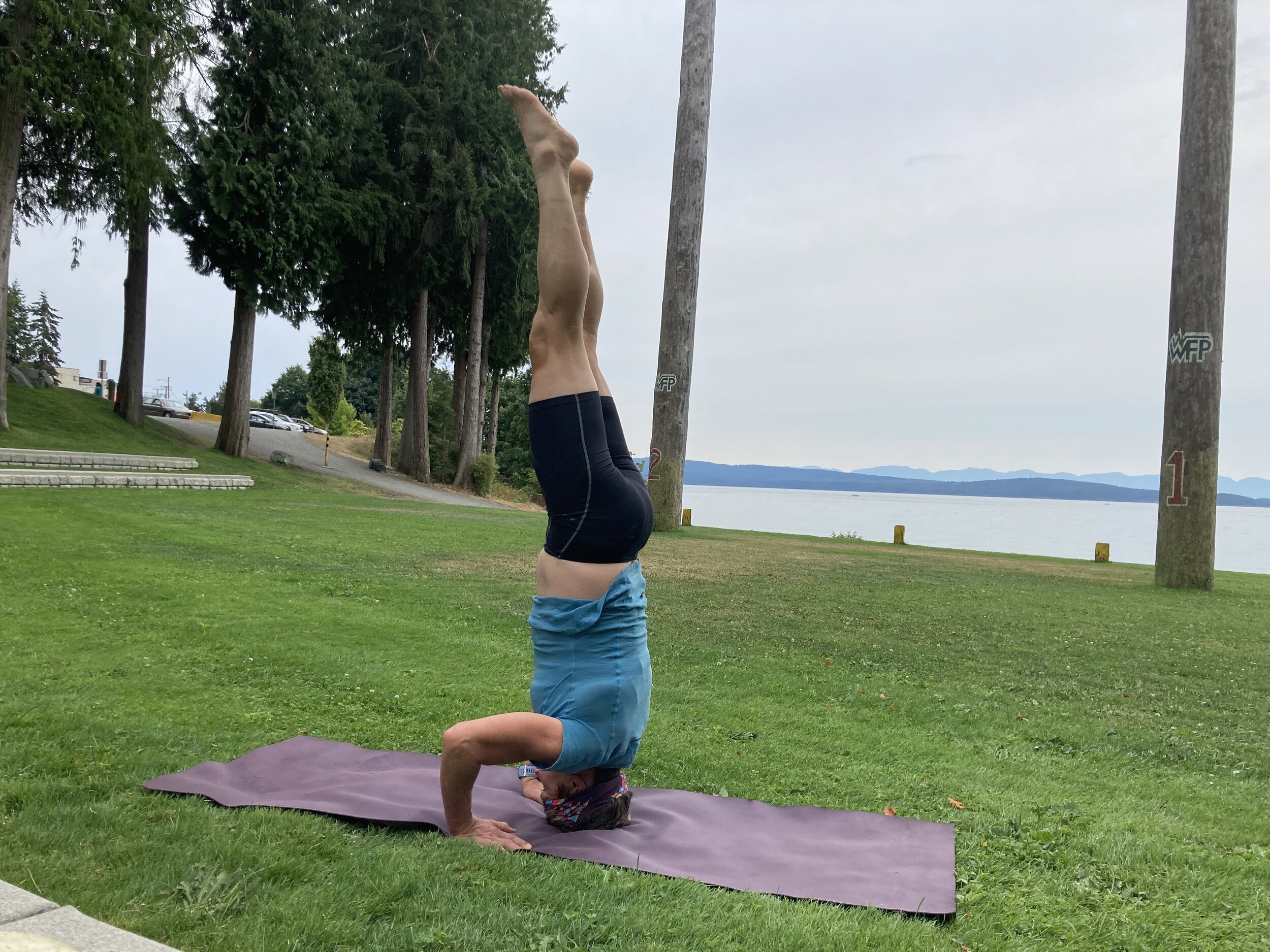
Yoga in the park.
We walked over to Willingdon Beach, a beautiful little park with green grass next to the ocean. I had my Maduka travel mat with me so I did some yoga in the park while David took a cat nap.
I noticed across the highway Putters Mini Golf. We had time for a round. It would be a fun way to kill more time. I haven't played in years, since I was a kid. I remember “Put and Bounce “ in Saskatoon growing up. Brought back memories. It was fun and in the end David beat me by one point. We are both pretty bad golfers, but it was a good laugh!
David kicking my butt at mini golf.
We walked to the BC Transit bus stop at the town centre mall to catch our bus to Lund. There were two other female hikers. One had a cast on her arm. I was thinking she must be pretty hard core to be hiking the SCT with what looked like a broken arm. None of my business what her injury was, just looked bad ass! Another male young hiker got onto the bus, mentioned he was hiking the entire SCT solo. That's a pretty cool adventure to be doing alone. The 45 minute bus ride weaved along the ocean and through residential back roads.
We finally arrived in Lund and started hiking along Finn Bay Road, then Sarah Point Road before joining the Spire Trail taking us to the SCT where we would hike 5 km to Manzanita Bluffs for the night. The hike was short but steep in sections and it was hot! David and I were each carrying an additional two litres of water, for a total of four litres each to be safe becauase Facebook posts said there was no water source at Manzanita. Needless to say with the weight of the extra water, I felt like a slug and my legs were feeling heavy up the climb.
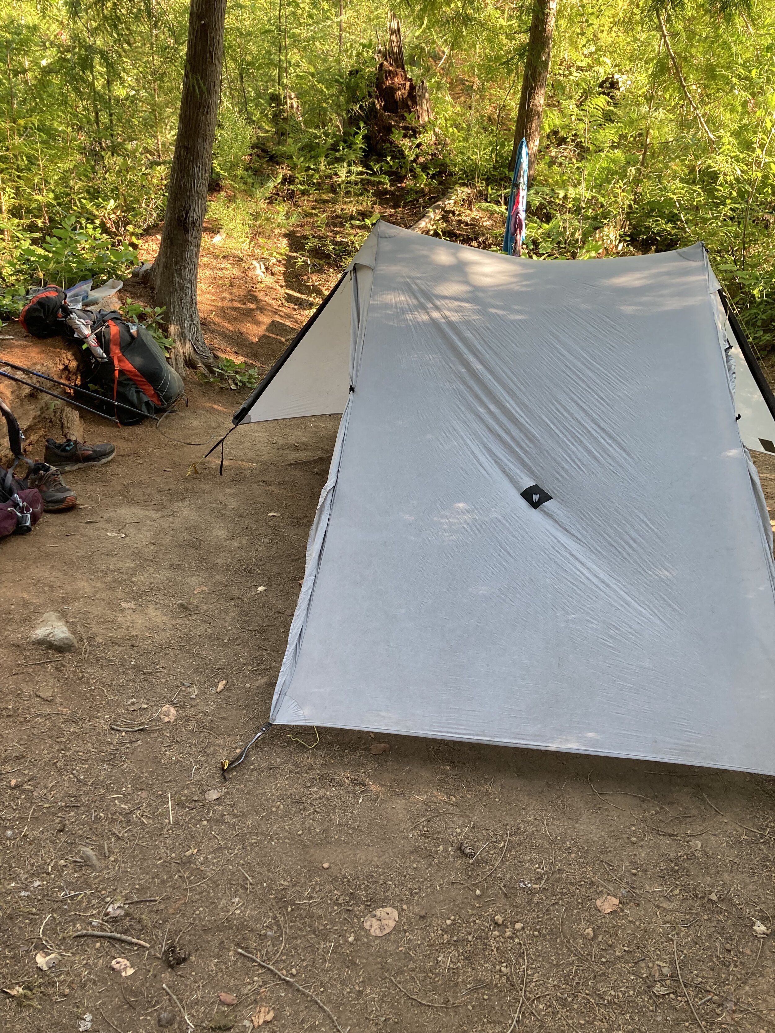
Campsite Manzanita bluff.
We arrived at Manzanita Bluffs around 5 pm. It had a beautiful hut and two outhouses – one that was composting closest to our campsite. Pickings were slim for finding a spot for our tent as it was a busy camp site. There were a total of 14 people camped out that night and two women camped in the hut. I admired the fact that these three ladies didn't know each other, they just met on the trail and had planned the whole SCT each on their own. So cool. They asked us about the trails that were ahead for them. I had pictures on my phone to show, but didn't want to ruin the surprise that awaited them. It was fun to replay the memories. We set up camp, ate our dinner of Amy's mac and cheese with tuna and dehydrated vegetables. I savoured a few sips of hiker wine with dinner. There was no food cache, but lots of room in the forest to hang our food packed in Opsak odourless bags within Kevlar grizzly bear proof sacks,well away from the campsite. You never want to leave any food around the tent or eat near you're tent either. Animals can damage you and you're belongings. If they smell any food they will likely want to eat it!
We were in our tent trying to sleep. It was hot and muggy and no breeze at all and no need for a sleeping bag. In the middle of the night I heard footsteps around the tent and rustling in the bushes. My heart was in my throat. I woke David up and all he said was “are they little footsteps are big ones “? I was happy we were not alone up there, hopefully it wasn't Big Foot.
Day 2: Sarah point out and back run /hike (32 km )
We woke up bright and early to the sound of thermarests being deflated as campers around us were packing up to begin their journey on the SCT south. The birds weren't as noisy in the am as I remembered in July on our first trip. Maybe they were sleeping in?
The official start of SCT at Sarah Point.
David as always, because that's his talent, had planned our run route – an out and back from Manzanita to Sarah Point – about 17 km each way. We weren't sure how runable the trails would be, but we had brought our run packs with us to travel light. We planned to camp another night at Manzanita, while everyone else was packing up. We just had to trust our tent, backpacks and food still hung in the trees would still be there when we got back from our run. Most through hikers on the SCT are loyal.
We ate our breakfast of oatmeal and dried fruit and I had my camper coffee. We still had about two litres of water from the night before, happy that we had carried in the extra. We set off on the trail on the way to Sarah Point, the first section was quite run-able. As we continued the trail became quite technical rooty and rocky and steep. Parts of it reminded me of Jocelyn hill section of Finlayson race course. It became more of a fast hike- run.
Four kilometres into the run we arrived at Wednesday Lake, where two hikers had camped on the rocky bluff, enjoying their coffee with the beautiful view of the lake. We waved and said hello and kept going .
Hike - run to Sarah point .
Next we came to Bliss Landing, a new campsite on the SCT not even on some of the maps. There were tent pads, a composting toilet and a food cache here. I stopped for a quick bathroom break taking advantage of the composting outhouse with toilet paper! Most do not have TP, so be sure to bring your own .
I was drinking a lot of water as it was hot and the air was stagnant. I misjudged how much water I had left and should have said something as we passed Hinder Lake 3 km past Bliss Landing. By the time we reached Sarah Point I was out of water and I regretted not suggesting to stop to filter at Hinder lake. I was so thirsty I'm sure I saw a water spout on one of the signs. It's amazing what your brain sees when you really need something. No that's called a hallucination.
We spotted a couple of hikers who had just got off the water taxi. I noticed their full Nalgene containers of water strapped to their packs. I wouldn't dare ask as I had made a rookie mistake. I soaked my Buff in the cold icy ocean just before we turned around. You can't filter ocean water! David still had about a half a litre left and he kindly offered me a few sips of his remaining piss warm water left in his pack. I was wishing for an aid station with cold Bubbly water, ice, Coke, beer anything wet. I reminded myself that the human body can go without water for about three days and that I had already drank about two litres earlier so I certainly won't die. I savoured the few sips of warm water from David's pack. We ran completely out about 10 minutes before arriving back at Hinder Lake. At this point I was feeling dehydrated and grumpy. Normally i would use Tailwind hydration on a long run, but today I didn't. So now I was in a calorie deficit as well as dehydrated. David gave me the CNOC bladder to fill up and since there was no easy access I took my shoes and socks off and waded into the warm, muddy lake. I filled up the bladder only so see it full of bugs and other stuff, so I dumped it out and tried to refill it again. Finally after filtering the water, David and I both drank about a litre each and I ate a few bites of a Hornby Island energy bar and felt better immediately.
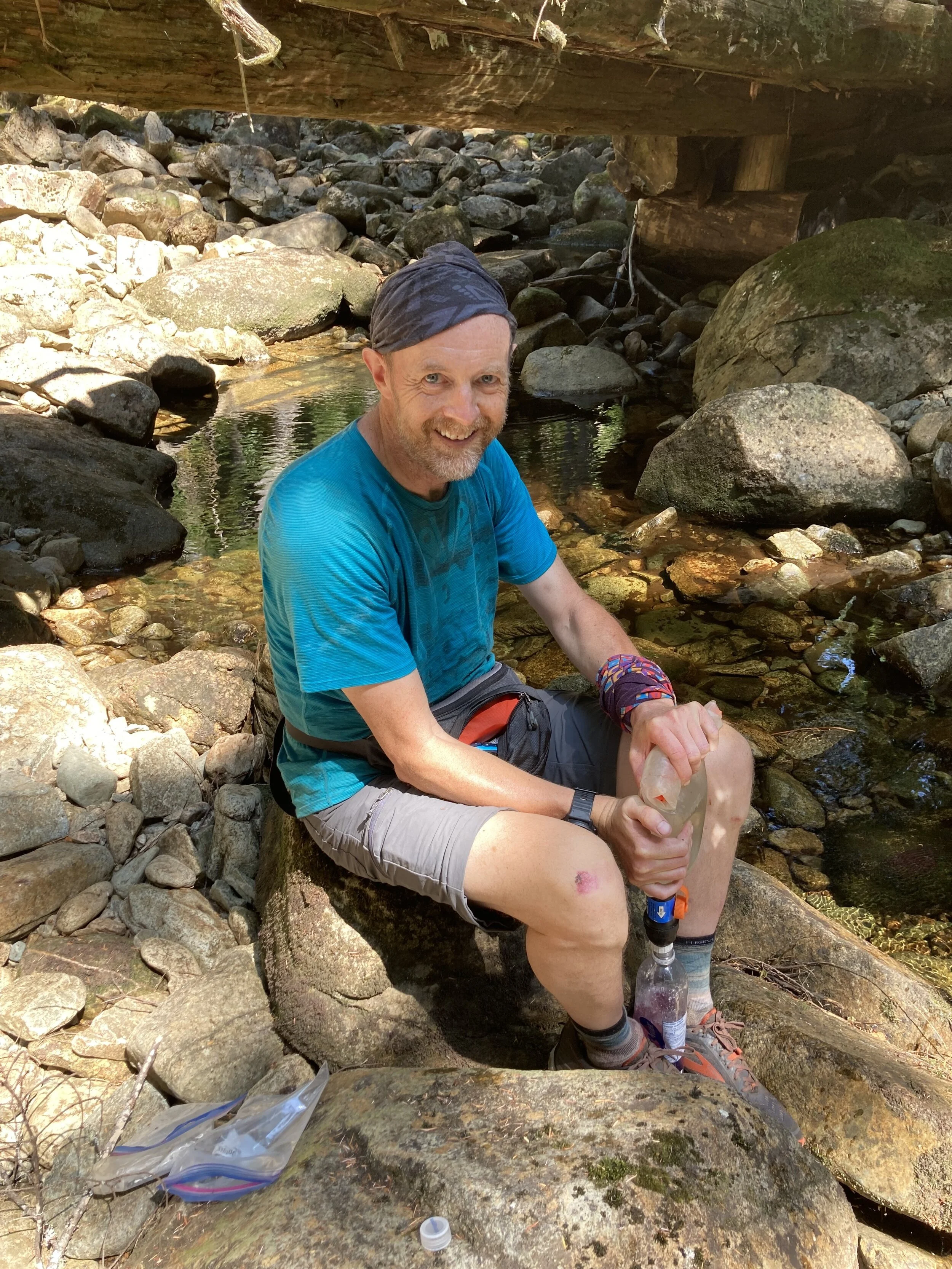
David filtering water at Appleton Creek
We planned to filter more water at Wednesday lake 6.5 km from Hinder Lake as it would be the last water source before heading back to camp at Manzanita bluff. When we finally got to Wednesday Lake I went in for a refreshing swim while David filtered more water, after cooling his feet off in the lake. I had my goggles with me this time. The lake was dark and I couldn't see a thing, so it must have been deep. I stayed close to the rocks as it makes me nervous to swim in unfamiliar lakes.
We chatted with two couples who had gone for a swim to cool off and now were leaving the lake on way to to Manzanita Bluffs. They seemed amazed with our attempt to run the trails maybe a bit crazy, but we also were not carrying our heavy back packs. The two women hikers that we saw on the bus, one struggling with possible heat exhaustion, were also cooling off at the lake and on way to Manzanita bluffs. David had noticed a flowing stream from the lake's outlet where we filtered six litres of water and carried an additional three litres of dirty water in the CNOC to be filtered later at the campsite. We passed the two women hikers who were resting on the side of the trail and caught up to the two couples as we fast hiked past them. I felt like a camel carrying all this extra water, but we were going to need it. I was feeling exhausted when we got back to our campsite, thankfully all of our stuff was still there. I made dinner and drank the rest of my hiker wine -feeling tipsy. The two couples rolled into the campsite ,followed by the two women. One of them was in bad shape from the heat so they had to stop numerous times to prevent from over heating. The woman with the cast asked how I was able to sleep on such a thin mat, which was my Manduka yoga mat strapped to the outside of my pack. I laughed as I explained it was a 1 kg travel yoga mat not for sleeping on. She said “ oh good you are human.” Funny .
We were able to get cell service here so I put on a yoga class from my Iphone “doyogawithme.com” inside the hut. The woman remarked “ are you doing a yoga class in there? We really need to get with the program“. It was nice way to end the day and stretch out my hips for tomorrows hike out to Little Sliammon Lake.
It was a quiet night, only eight of us in the campsite that night and a cooler breeze. We watched one episode of Grey's Anatomy before bedtime. I can't live without it . That's as close to “glamping” as I'll get.
Day 3 : Manzanita Bluffs to little Sliammon lake (27km).
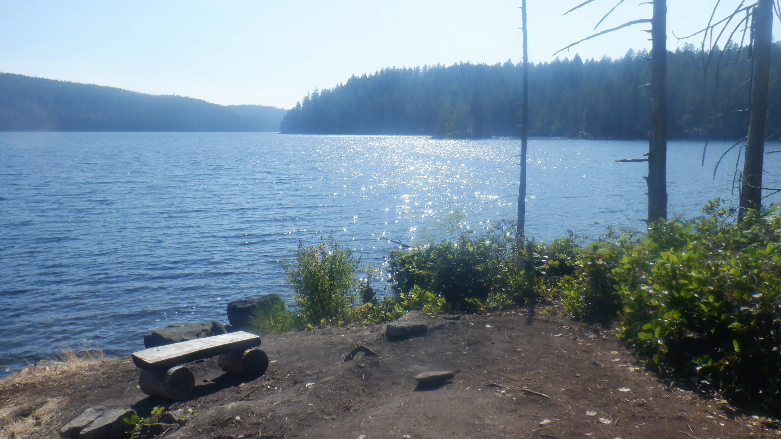
Sliammon lake - view from camp area.
Sunday morning up by 6 am, packed, ate breakfast and on the trail by 7:30am. We headed southbound, hiking down the bluffs enjoying the cool breeze while it lasted. This section, to homesteads was easy, fast, smooth and very runable. I'd wished we could have run this section, but little did we know the day before what this trail was like and wasn't our plan. Next time! We ran into three hikers that had told us someone had left a cooler of drinkable water for hikers at Malasapina Road. Through hikers call this “trail magic.” We topped up our water here and carried on.
Walking through Fern Crossing .
This stretch of trail was enjoyable and all in the forest. We didn't see a soul, it was quiet. Our next stop was pretty little Plumper Creek, we stopped to filter water and had an early lunch of Natures Path organic frosted Cherry pop tarts with local grass fed teriyaki flavoured beef jerky. Together they tasted amazing! I would never eat this at home, but on the trail everything tastes good! I also added some expired Berry flavoured GU tablets I'd purchased from Frontrunners to my water for the extra electrolytes. They tasted fine and made the water fruity. We had a 200 metre climb ahead of us to Rieveley's Pond Hut . It had a hut, composting toilet and a flat area for a few tents. It was vacant and we kept going. Next stop was Appleton Creek where we stopped to filter more water from the stream under the bridge. There were some stunning water falls along this stretch of trail. We came across several day hikers, including a black dog, at first glance looked like a black bear cub. David was ahead of me and I saw the hairs on the back of his neck stand up. Thankfully it was only a black lab.
Trail leading to Little Sliammon lake.
Our destination was Slimammon Lake. We finally arrived at 4:30pm. It was a nice campsite by back country standards, in the shade with flat areas for tents. We saw the couple we had seen at yesterday at Wednesday Lake setting up camp. I was dying to go into the lake as it looked cool and beautiful. It was early and we decided to keep hiking another 3 kms to Little Slimamon Lake. It was hot and muggy and the trail was steep and slow going. We finally arrived at Little Sliammon Lake by 6 pm.
Shangri la campsite.
The campsite, Shangri -la, was nice and had room for a few tents. Nobody was there so we took the deluxe campsite which was large and pancake flat and had a nice log alongside it as a bench. There was a covered picnic shelter close by and a stinky outhouse that honestly was so disgusting I thought someone died in there. I preferred to dig a cat hole the next day to do my business.
Little Sliammon lake haunted canoe.
There was a nice little dock leading into the lake avoiding all the lily pads and frogs that housed close to the beach. I had heard voices on the water and saw a canoe with two people in it. As we walked to the lake with our bear spray and the bear bags, the two people had vanished but the canoe was still there. Where did they go? It felt a bit eerie . The canoe had a big hole in it and was held together with duct tape. I jumped into the lake to cool off, but I was a bit freaked out so I didn't stay in for long. Too many creepy movie memories of Jason in Friday the 13th. The iconic madman who haunted Camp Crystal Lake. I could just imagine him pulling me under water trying to drown me. David is a none swimmer so I'd be destined to be a corpse on the bottom of the lake. I'm okay, that's my anxiety talking.
Swimming in Little Sliammon lake
David heard deep groaning /growling noises in the bushes. We heard coyotes howling too. I felt like I was in a wilderness movie. I howled back in a feeble attempt.
We ate our dinner of Ramen noodles, tuna and rehydrated vegetables and dried mango for dessert.
I sure could have used hiker wine tonight. I did some yoga on the picnic table before bed. That night I didn't hear a soul, it was dead quiet in the campsite.
Yoga in the hut at Shangri la “ haunted “ campsite
Day 4 -The hike out (17 km)
This was our last day on the SCT. We were packed up and on the trail by 8:30am hiking to Powell River. The trails were nice and flowy and easy to hike along. Once out of little Sliammon Valley the trail descended before our last climb over Scott Hill and down into Shingle Mill. A lot of hikers stop here for a pint. but we didn't. We took a short break along the bluffs, and enjoyed the beautiful views. We hiked over the bridge on Highway 101, rejoining the trail on the south side of Powell Lake. The nice smooth trail eventually took us to Mowatt Bay, where we started the SCT southbound on the July long weekend. We officially had completed the entire SCT.
View of Wildwood on the bluffs.
We stopped at Mowatt Bay for a hour while I swam along the bouys in Powell Lake. The lake was clean, cold but beautiful. The beach was a bit rocky and needed to watch for logs in the water. I had to get in some swimming for the HPR swim-run event Aug 15, which is an event consisting of 5 swims, and 5 runs for a total of 5 km swimming and 20 km trail running. I did this event last year and really enjoyed it!
David relaxing on the beach while I was swimming in Powell River.
David relaxed on the beach in the shade under his hiker sun umbrella while I swam. After an hour or so we left Mowatt Bay, hiking up the road 120 meters elevation, then onto a BC Hydro service road and finally into Millenium park trail system. One of the trails was called “triple bypass“ appropriately named. This trail through a maze of forest took us back to Wellingdon Park and we walked back into Powell River.
Awesome food at Costa del Sol !
We had spotted a restaurant called Costa del Sol Latin Cuisine. We were famished and thirsty. David had a large bottle of Tin Hat IPA and I had a red wine sangria and a pink lemodade maragrita . OMG both were so good! I had a yam and fish taco with fresh salsa and David had a pulled pork and pickle burrito. The food was great, service was outstanding and the outdoor patio was funky and fun!
When we left a couple waiting in line asked if we had hiked the SCT. I replied “we sure did.“ Secretly I wished we could restock our backpacks and head back to Mowatt Park and begin the hike again on the southern section.
Enjoying ice cream at Wild’s .
We wobbled up to Wild's for ice cream. They make wicked vegan ice cream with real fruit. I had pistachio – peppercorn and grapefruit granita in a plant based waffle cone and David had fresh strawberries blended into vanilla . Both were amazing ! A must go. Open from 1-8pm.
Well our holiday hike over, again I felt sad but happy about our amazing adventure completed safely.
It was back to reality the next day. Catching the ferry to Little River we drove home to Victoria getting in at 10 pm. Time for bed . Wed 6:29 am November Project and back to work for both of us. Back to reality. I was happy I had booked a massage before work too :)
David waiting for ferry . personal shade my Six Moons design sun umbrella .
Final thoughts!
The SCT is my favorite 180 km point-to-point through hike trail in BC. I love Powell River too. The town is hiker friendly. I would move there in a heartbeat. I only noticed two massage therapy practises there close to the ice cream shop. My dream would be to open a cat friendly tiny house massage therapy clinic ( when I win the lottery).
My favorite hike on the SCT: grueling climb up Tin Hat for the 180 degree views and sunrise.
My favorite campsites: tie between Rainy Day Lake and Shang-ri La
My favorite lake to swim in: Powell lake . On the SCT: Inland lake on Anthony Island
My favorite hiker meal : Ramen noodles, with tuna in a bag, re-hydrated veggies.
Next time I would like to take the boat to Sarah Point and hike the SCT in one go and take 7-10 days to do this.
David hiking the last stretch of the SCT.
Big thank you to David Marlor who is the trip planner, navigator, human GPS and best adventure hiking boyfriend ever. I love you!
Nothing but good memories on the SCT. Thank you for reading!


